Hoping everyone had a wonderful Thanksgiving break and now it is back to work and school. The new week is starting off with more sunshine and drier conditions. Outside of a few showers along the coast, it is looking great. By Tuesday, a low pressure area travels Northeast and front enters Florida. This will help winds turn out of the South-Southwest to ramp up temperatures.
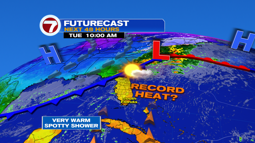
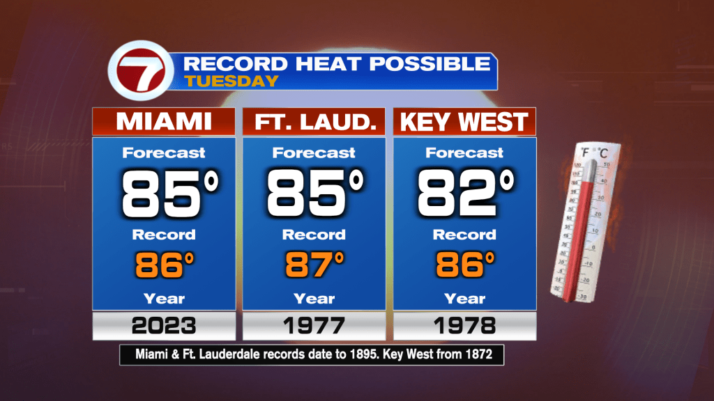
In fact, we will be flirting with records in some areas between Broward and Miami-Dade.
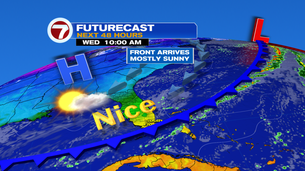
Along and ahead of the front we are not expecting moisture, but once it arrives on Wednesday, it will be nice with near average temperatures returning (highs near 80 and lows in the mid to upper 60’s). Expect a seasonal finish to the week.
Have a wonderful day South Florida and make it a safe one!
Vivian Gonzalez
Meteorologist, AMS Certified
WSVN Channel 7