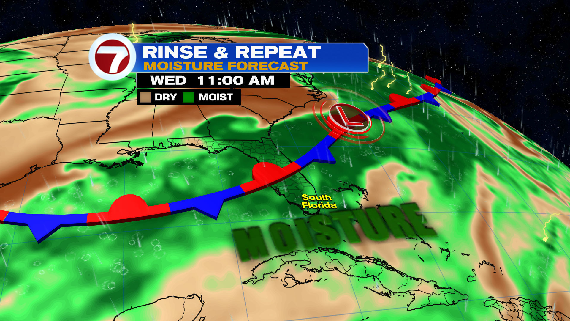
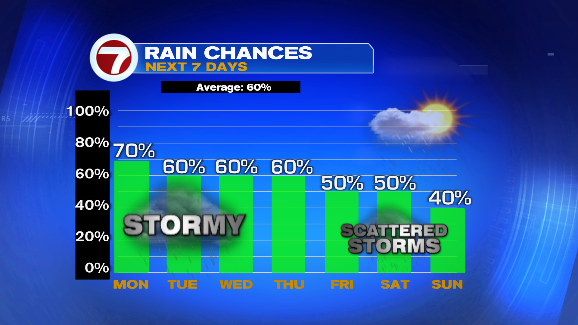
Another front is forecast to stall over Florida with the same setup as last week. This will leave the air ripe for rain. Therefore, look for early sunshine and afternoon clouds with a good chance of seeing rain and storms.
Long range models showing the front sagging South enough into the weekend, that it could bring in some drier air from the North to bring down rain chances.
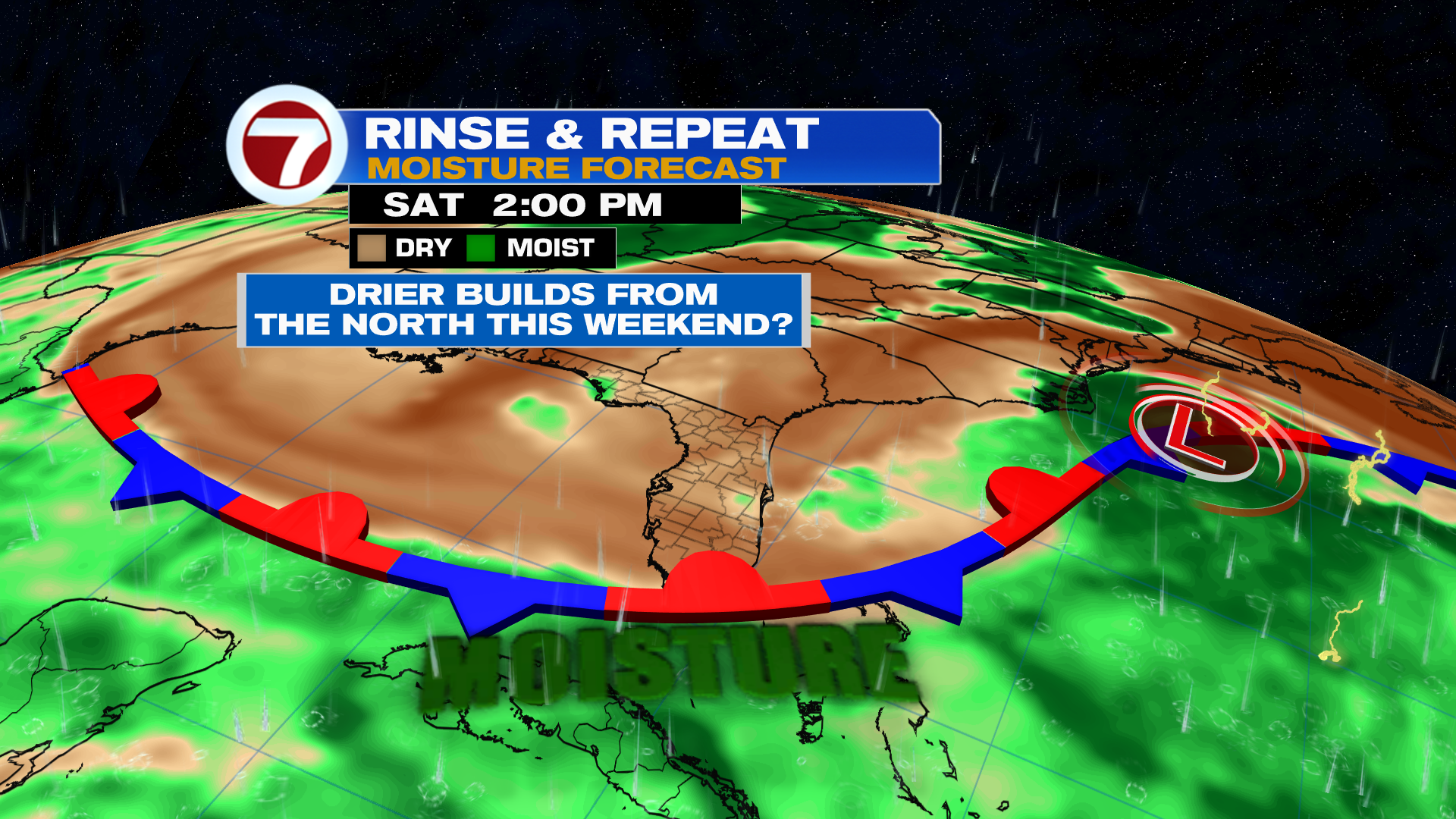
Typical rain chances for rainy season will be in place through most of the week with fewer storms expected this weekend.
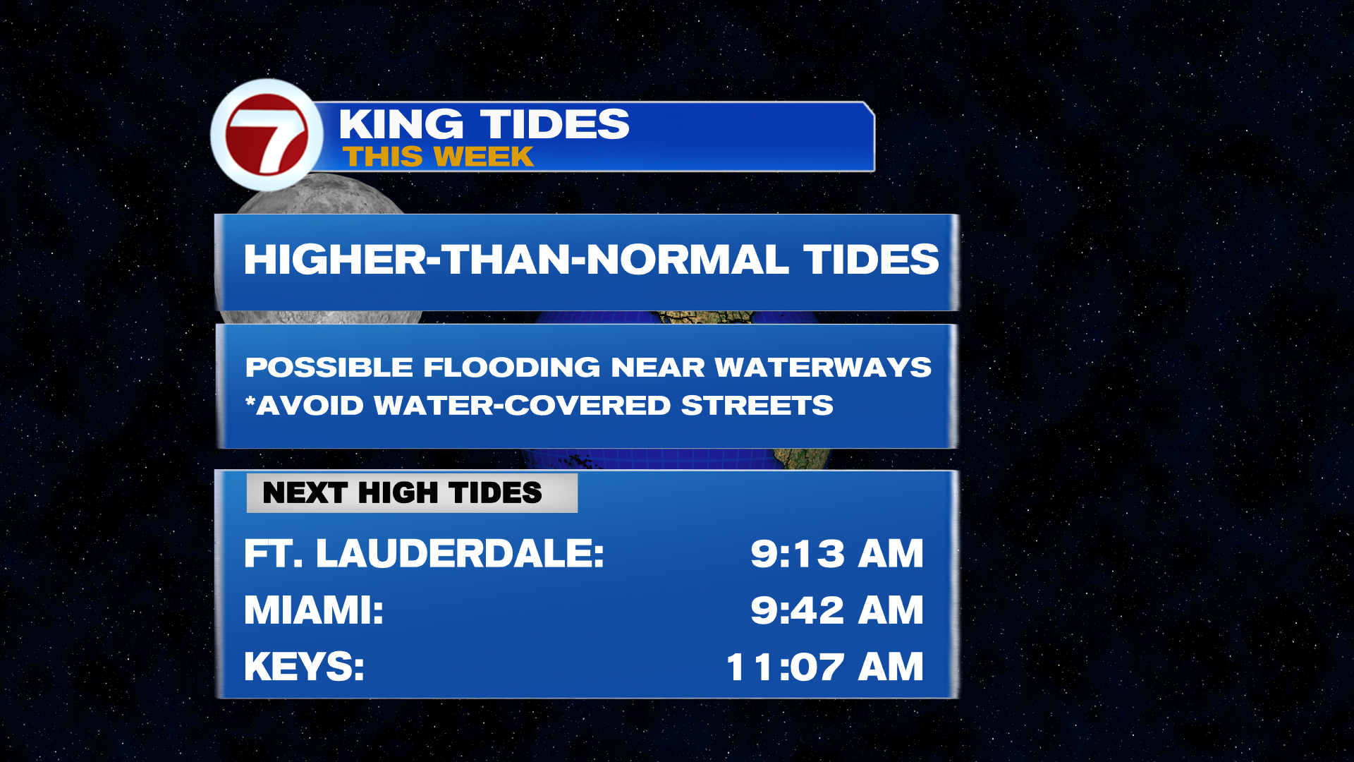
King Tides are back! Nuisance street flooding possible on the bay side for the upper Florida Keys during times of high tide. We have the full moon of September cycle underway and that is creating higher-than-normal tides for a few days.
Have a wonderful day South Florida and make it a safe one!
Vivian Gonzalez
Meteorologist, AMS Certified
WSVN Channel 7